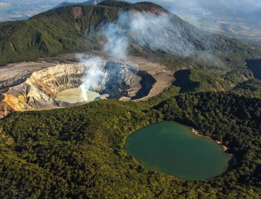
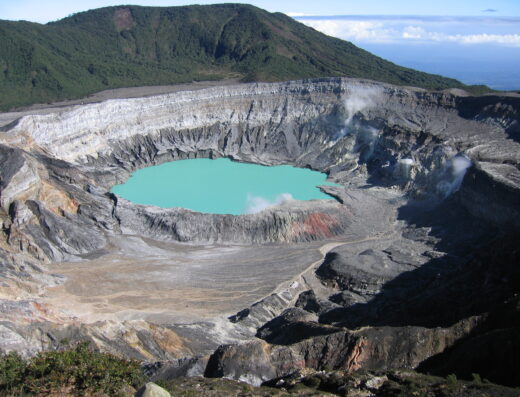
At the summit, there are two craters – the main one measures 1.5 km in diameter and is 300 meters deep. The Botos lagoon, which is a source of cold water and solely fed by rainwater, is also located at the summit and drains into the Angel River, a tributary of the Sarapiqui River. The volcano continues to emit large amounts of gas and water vapor through various fumaroles situated in the inner cone of the crater. Other volcanoes identified in the area include Chompipe, which stands at 2,259 meters above sea level, Turu at 2,139 meters above sea level, Cerro Cacho Negro at 2,250 meters, and Barva, which has several craters, including the well-known Tres Marias at an average altitude of 1,725 meters.
Route 1: From San José, take the highway to the city of Alajuela. From there, take Route 712 to Poasito, passing through the communities of Itiquís and Fraijanes, following the signs to the volcano.
Leave a Reply